Lidark: Underground LiDAR Map
alexandre kaczor

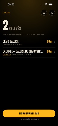
Wherever GPS can't reach, keep your thread. Underground there is no signal and no GPS. Lidark uses your iPhone's LiDAR scanner to draw the plan of the gallery as you walk, and lead you back to the entrance. For caving, urban exploration, quarries, mines and tunnels, and for the basement or attic at home too. THREE REASONS TO KEEP IT 1. The way back to the entrance, offline: Lidark computes the real distance to walk along your path and an arrow points to the next stretch. A 3D scanner shows you what you scanned; Lidark tells you how to get out. 2. A clean 2D plan, free to export: a sharp vector plan to share as an image or a printable PDF, with no subscription and no account. 3. A 3D survey textured with the photos taken during the scan (Lidark Pro). HOW IT WORKS 1. Start a survey at the entrance: the LiDAR picks up walls and floor. 2. Walk normally: the minimap is drawn live (walls, floor colored by altitude, path, distance to the entrance). Drop markers: junction, shaft, danger or free. 3. To get out, follow the arrow: the shortest way along what you actually walked. The survey is saved on your iPhone with its 2D plan and its 3D model, markers included. WHEREVER GPS CAN'T REACH: MORE USES The same principle works elsewhere: - Basement, cellar, attic, crawl space, garage: the plan of dark places with no signal. - Room before a renovation: a PDF plan and a 3D model to send to your contractor, viewable in the free web viewer. - Technical room, gallery, tunnel: a quick survey, to complete with your instruments. - Underground car park: an arrow back to your starting point when looking for your car or the exit. - Crypt, vaulted cellar, authorised cavity: a dated 3D model for your archives. - 3D creators: a scanned room, exported as GLB, OBJ or PLY for Blender. The survey is indicative: Lidark is not a certified measuring instrument and replaces neither a land surveyor nor a quantity surveyor. BUILT FOR DARKNESS Pure black screen to save battery, giant figures, large touch targets made for gloves. A moon button turns everything red to protect your night vision. The torch turns on by itself in the dark. Moving too fast, not enough detail, tracking lost, low battery: vibration and a message, and nothing is recorded until tracking is reliable. EXPORT AND RESUME 2D plan as an image or a printable PDF: free. PLY, OBJ and GLB export of the 3D model: Lidark Pro. Come back the next day: Lidark realigns to the same frame of reference and you extend your survey (Lidark Pro). FREE WEB VIEWER Open your PLY, OBJ and GLB files in your browser at lidark.app/en/viewer/, no account: the file stays on your device. FREE, AND A ONE-TIME PURCHASE TO GO FURTHER Free: scanning, the minimap, the way back to the entrance, markers, the 2D plan and its image/PDF export, 3 saved surveys. Scanning and the way back are always free. Lidark Pro, a one-time purchase (6.99 € in France), no subscription: unlimited surveys, resuming a survey, the textured 3D model, PLY, OBJ and GLB export. YOUR PRIVACY No ads. No account. No data collected: your surveys stay on your iPhone. The camera is used for tracking and for the model's textures, on the device, and nothing is sent. Everything works offline. COMPATIBILITY iPhone with a LiDAR scanner (iPhone 12 Pro and later Pro models), iOS 18 or later. On another iPhone you can browse the example survey, but not scan. Interface in English and French. SAFETY Lidark is a navigation aid, not a safety device: tracking can degrade, the battery can run out, the phone can overheat. Never rely on it as your only way to find the exit. Do not go down alone, without backup lighting or a power bank, or without telling someone your route. Respect access bans and local rules.
Screenshots