Canada Prospector
Nigel Brown

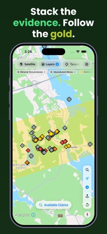
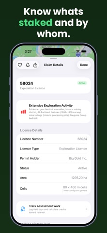
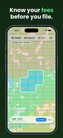
Canada Prospector is a native mapping app built specifically for gold prospecting and mineral exploration — covering Nova Scotia, Ontario, and British Columbia. See mining claim boundaries colour-coded by expiry, browse mineral occurrences and drill hole records, and explore bedrock geology, fault lines, and geochemistry — all on one fast, easy-to-use map. FREE FEATURES: Claim boundaries for all three provinces, refreshed nightly and colour-coded by expiry (active, expiring within a year, expiring within 90 days) More than 40 data layers across the three provinces, spanning geology, geochemistry, geophysics, and historic mining Save up to 3 favourites and 3 field notes (unlimited with Pro) Satellite imagery and detailed records one tap away DATA LAYERS: Every province — Claims, Staking Grid, Mineral Occurrences, Mines, Drill Holes, Bedrock Formations, Surficial Geology, Faults, Water & Streams Nova Scotia — Available Staking Ground, Abandoned Mines, Ice Flow, Gold Geochemistry, Historic Mining Areas, Mine Tailings, Coal Seams & Workings, Anticlines, Restricted & Protected Areas, Crown Land, Property Parcels, Oak Island Treasure Licence, Aeromagnetics, Radiometrics, Gravity, VLF-EM Ontario — Available Staking Ground, Abandoned Mines, Geochemistry, Iron Formations, Dikes, Gold Mines & Deposits, Mine Workings, Exploration Permits, Patents & Leases, Withdrawn Lands, Crown Land Use, Protected Areas British Columbia — MINFILE Producing & Past-Producing Mines, Regional Geochemistry, Assessment Reports, Work Permits, Mineral Reserves, Crown Granted Claims, Protected Areas PRO UNLOCKS: Pro Map Layers — Expired Claims, LiDAR Hillshade with coverage outlines, the prospecting heatmap, and terrain hillshade, contours and 3D Claim Assessment — multi-layer prospectivity scoring for any claim in one tap Assessment Work Tracker — Nova Scotia Form 10/11 PDFs, Ontario cost summaries with receipt photos, BC Statement of Work summaries Prospecting Targets — ranked locations where multiple data sources agree, with commodity filtering and an open-ground check (Nova Scotia and Ontario) Staking Calculator — select cells for a live fee and area total, with registry-ready output like NovaROC Tract Descriptions Faribault 1898–1919 Survey (Nova Scotia) — exclusive digitised shafts, veins, faults, and anticlines Claim Watch & Notifications — expiry reminders at 90, 30, 7, and 1 day, plus an alert if a watched claim leaves the registry early Open Ground Alerts — watch an area and get notified when claims there lapse, with a ledger of exactly which parcels opened Expiring Claims — province-wide expiry list, recently released ground, and your watchlist in one view Staking History — the chain of title for a cell, where the province publishes it What Is Here — tap anywhere for nearby occurrences, geochemistry, drill holes, and mines Near Me Search — occurrences, mines, drill holes, and more within a chosen radius of your GPS Export to KML, GeoJSON, or CSV for Google Earth and GIS tools Offline Field Mode — search and downloadable province data packs work with no connection, plus downloadable LiDAR areas (geophysics streams live tiles) Unlimited saves and field notes with photos — no cap on favourites or pins Built by a Nova Scotian prospector — whether you're staking your first claim or doing desktop research before a field trip, from the Atlantic to the Pacific. Data is drawn from each province's public registry and open geoscience data. Canada Prospector is independent — not affiliated with or endorsed by any government, and nothing in it is legal advice. Canada Prospector Pro is an auto-renewing subscription: $8.99/month or $79.99/year. Payment is charged to your Apple ID at confirmation of purchase and renews automatically unless cancelled at least 24 hours before the period ends. Manage or cancel in your App Store account settings. Terms of Use (EULA): https://www.apple.com/legal/internet-services/itunes/dev/stdeula/
Screenshots