Drone Weather Forecast: UAV
Renan Rafael Bertoldo

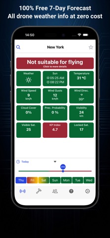
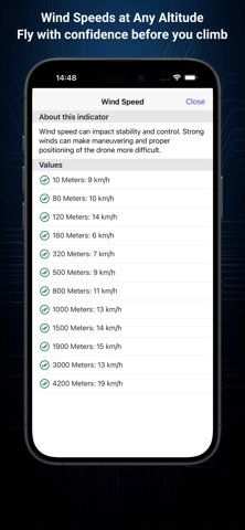
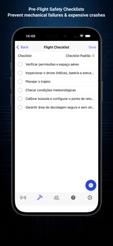
Is it safe to fly your drone right now? Drone Weather Forecast answers with one colour — green, yellow or red — checked against the limits of your own drone. Pick your model from 79 presets (DJI, Autel, Parrot, Fimi, Potensic, Holy Stone, Ryze and more) and every hour of the forecast is compared with its wind and temperature limits. Or set your own. FREE, NO ADS • 7-day hourly forecast: temperature, rain, cloud cover, visibility, sunrise and sunset • Wind speed, gusts and direction, hour by hour • KP index: geomagnetic storms that disturb GPS and compass • Visible GPS, GLONASS, Galileo and BeiDou satellites for your position • No-fly zone map with official airspace data and DJI GEO zones, including the height limits around airports — works offline • Photo spots: a map of viewpoints, waterfalls and more, with airspace status and forecast • Custom pre-flight checklists and flight history • Pilot community: flying spots and aerial photos • km/h, m/s, mph or knots · °C or °F · metres or feet • Available in 16 languages PRO — ANNUAL PLAN OR LIFETIME PURCHASE • Wind and gusts at altitude, from 10 m up to 4,200 m • Hourly forecast table with every indicator • Wind compass with magnetic interference warning • Apple WeatherKit as forecast source • Favourite locations • Post in the pilot community • Multiple drones with individual flight settings Both plans unlock the same Pro features: • Annual: a yearly subscription that renews automatically unless you cancel it in your Apple Account settings. After cancelling, Pro stays active until the end of the paid period. • Lifetime: a one-time purchase. Pay once, keep it forever. Pro is linked to your Drone Weather account and can be restored on other devices signed in with the same account. Already own lifetime Pro? You keep it. Forecast times are always shown in the local time of the place you search, not your phone's. The no-fly zone map is a planning aid. Always follow your local aviation rules. Questions or ideas: support@droneweatherforecast.app Terms of Use: https://droneweatherforecast.app/terms · Privacy Policy: https://droneweatherforecast.app/privacy
Screenshots