Inverza
Marcel Strelow

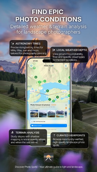
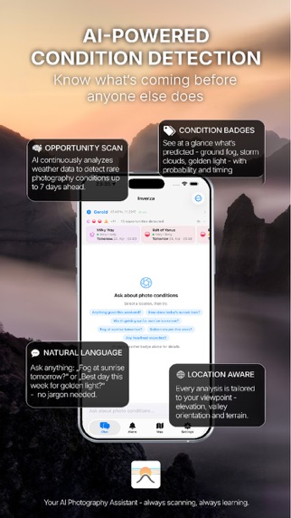
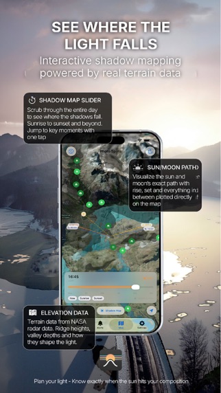
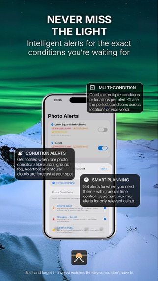
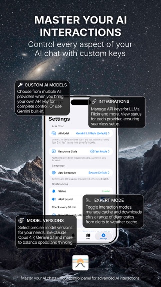
Inverza is a weather intelligence app built for landscape photographers. It blends real-time forecasts from multiple models, live ground truth from airport METAR stations, GPU-accelerated terrain shadow mapping, and AI analysis, so you're at the right place at the right time. ASK AI ABOUT YOUR SHOT Type a question like "Will there be fog at Geroldsee tomorrow morning?" and get an informed answer grounded in live weather data. Inverza detects 16 photographic conditions: colorful dawn, golden clouds, ground fog (with marine and steam-fog paths), hoarfrost, dramatic storm clouds with phase-aware approach and departure windows, Milky Way, aurora, Belt of Venus, reflecting waters, soft light, full moon silhouette, Brocken spectre, lenticular clouds over mountain ridges, and more. Each comes with a confidence score and timing. The built-in AI works out of the box, no key needed. Bring your own Claude, Gemini, or ChatGPT key for more powerful models. NEVER MISS CONDITIONS AGAIN Set background alerts at your favorite locations and get notified hours before conditions align. Smart proximity filtering focuses on locations within driving distance. Multi-location alerts let one alert watch several spots at once, with reordering for priority. DISCOVER & PLAN PHOTO SPOTS Browse an interactive map filled with photography points of interest from OpenStreetMap: viewpoints, waterfalls, castles, bridges, lighthouses, and more. Save curated spots, set viewing directions, and pair each spot with a photo subject pin (a mountain face, lighthouse, lake, or castle) so the AI reasons about lighting your subject, not just where the sun is. A 360° Horizon Paths chart shows sun and moon arcs against the terrain at any spot. SEE WHERE SHADOWS FALL A GPU-accelerated terrain shadow overlay (NASA SRTM elevation, Metal compute) shows exactly where sunlight reaches up to 30 hours ahead. Scrub the time slider or jump straight to sunrise or sunset. The map also supports 3D terrain, Look Around previews, and live sun and moon direction lines. DARK-SKY AWARENESS Milky Way and Aurora detections factor in local light pollution via a bundled global Bortle raster (NOAA VIIRS, ~1 km resolution). Inner-city skies hard-gate; suburban skies caveat realistically. FREE TRIAL & SUBSCRIPTION 14 days free with full access, then $4.99/year. No paywalls, no tiers, cancel anytime. BUILT FOR PHOTOGRAPHERS Made by a landscape photographer tired of checking five weather apps and still missing the fog. No account, no tracking, no ads. Five languages: English, German, French, Spanish, Italian. PRIVACY Inverza does not require an account and does not collect personal data. Weather queries are location-based but not tied to your identity. See our full GDPR-compliant privacy policy for details. Terms of Use: https://inverza.app/terms Privacy Policy: https://inverza.app/privacy
Screenshots