Berlin Wall Explorer
Mehmet Gokhan Memik

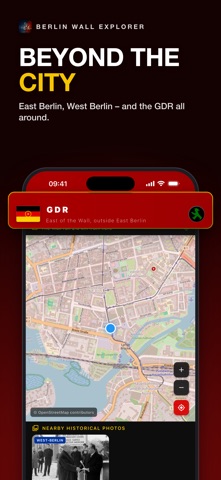
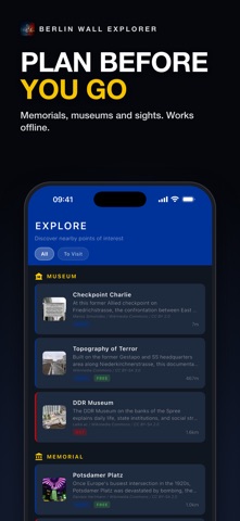
Stand where the Berlin Wall stood. Berlin Wall Explorer turns the city into a living map of the Cold War. Walk through Berlin and the app tells you, in real time, whether you are in former East Berlin, West Berlin or the GDR territory that surrounded it — and exactly how far the Wall ran from where you stand. Independent app: not affiliated with any government or government agency. Sources are listed at the end. WHERE WAS THE WALL? • Live side detection: East Berlin (GDR), West Berlin (FRG) or GDR territory, based on your location • The Wall's real, mapped route on an interactive map • Distance to the Wall — "The Wall ran 670 m from here", or "You are standing where the Wall stood" at places like Checkpoint Charlie and Bernauer Straße • The whole app changes with your side: bold red and yellow in the East, clean blue in the West HISTORY AROUND YOU • Historical photos from the German Federal Archives (Bundesarchiv) and Wikimedia Commons, taken near where you are standing — 1946 to 1990 • Landmarks, museums and memorials nearby, sorted by distance: Brandenburg Gate, Checkpoint Charlie, East Side Gallery, the Berlin Wall Memorial at Bernauer Straße, Tränenpalast, Stasi Museum, DDR Museum, Glienicke Bridge, Oberbaumbrücke, Teufelsberg and more • Mark the places you have visited and plan the ones still to see THE NIGHT THE WALL OPENED • New: follow 9 November 1989 hour by hour, from Schabowski’s press conference to the first open checkpoint at Bornholmer Straße and the new crossing at Potsdamer Platz • Eight places you can still visit, with archive photos from those days, a map and walking directions MADE FOR TRAVELLERS • Plan before you go: browse Berlin's photos and sights from anywhere in the world • Works offline: the Wall's route lives on your phone, and places you have loaded stay available without a signal • 10 languages: English, German, Turkish, Spanish, French, Italian, Portuguese, Russian, Ukrainian and Arabic PRIVACY No account, no ads, no tracking. Your location is used to show your side of the Wall and the history near you; anonymous usage statistics never include where you are. SOURCES Historical information and photos come from public sources. Berlin Wall Explorer is not affiliated with any of them. • German Federal Archives (Bundesarchiv): https://www.bundesarchiv.de • Berlin Wall Foundation: https://www.stiftung-berliner-mauer.de • State of Berlin – The Berlin Wall: https://www.berlin.de/mauer/ • Wikimedia Commons (CC BY-SA): https://commons.wikimedia.org • Map data © OpenStreetMap contributors: https://www.openstreetmap.org/copyright
Screenshots