Tabide: Ski & Hiking Maps
GUOHAO ZHU

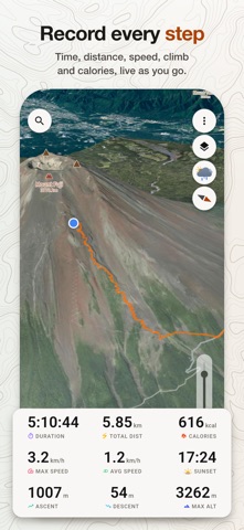
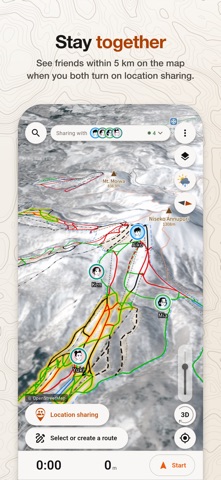
Maps, weather and memories of your day, together in one simple app. Tabide makes it easy to explore Japan's mountains, ski resorts and hiking trails in 3D. Find your next destination, plan a route and record your day on the snow or trail. Every feature is free. No ads, subscriptions or in-app purchases. Start exploring maps, weather and places without an account. EXPLORE THE SLOPES • Explore over 400 ski resorts across Japan. See lifts and runs on the map, with ski runs colored by difficulty. • Browse more than 300 resort guides for trail maps, webcams, snow reports, rentals, onsen and places to stay. PLAN YOUR NEXT HIKE • Search over 22,000 peaks and choose from more than 1,000 hiking courses, or build your own route along mapped trails. • Set your pace, add rest breaks and overnight stops, and see estimated arrival times, elevation changes, sunrise and sunset. • Check the weather along your route. Follow your progress as you walk and see when you go off route. • Save your plans and export routes as GPX files. CHECK THE WEATHER • Check the weather up to 14 days ahead at your destination or along your route. • Explore nine weather maps: wind, gusts, temperature, precipitation, clouds, pressure, new snow, snow depth and waves. • Play the timeline to see how the weather is expected to change. Tap the map to check wind speed, temperature and more. GET TO KNOW THE TERRAIN • Switch between outdoor maps, elevation maps, aerial photos, winter satellite images and recent satellite imagery. • See trails, huts, ridges and valleys in 3D. Use Focus to hide labels and make the terrain easier to see. • Download maps for an area or along a planned route to use without a signal. RECORD AND RELIVE YOUR DAY • Choose from 16 activities to record, including skiing, snowboarding, hiking, cycling and kayaking. • Track time, distance, speed, ascent and estimated calories burned as you go. Review each ski or snowboard run separately. • Keep recording with the screen off and see time and distance on your Lock Screen. • Add photos from your day and replay your track in 3D, with elevation and speed charts. • Import and export activity recordings as GPX files. FRIENDS AND FAVORITES • Add friends by Tabide ID or QR code. See each other on the map when you're within 5 km and both have location sharing on. • Choose who can see your location and stop sharing at any time. • Organize favorite places in lists with emoji markers, and add your own landmarks with a long press on the map. • Sync activities, plans and favorites across your devices. From Ski Slopes to Summits.
Screenshots