TopoXY: Coordinate Converter
Darius Cirjan

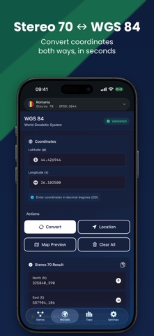
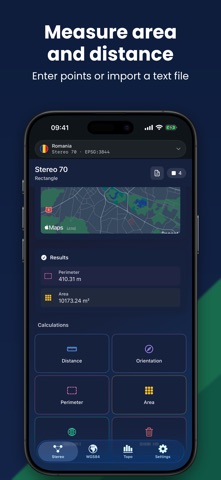
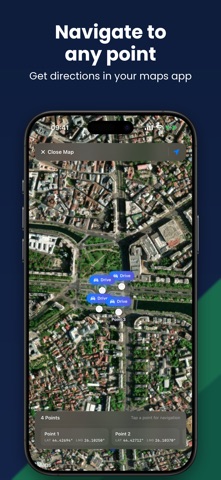
TopoXY converts coordinates between WGS84 and the national grids of Romania, Poland, Czechia, Slovakia, Italy and Germany, for surveyors, civil engineers and GIS professionals. Pick your country once. TopoXY loads the right coordinate reference system and keeps it for every conversion, calculation and map you open. SUPPORTED COORDINATE SYSTEMS • Romania: Stereo 70, EPSG:3844 • Poland: PUWG 1992, EPSG:2180, and PUWG 2000 zones 5 to 8, EPSG:2176 to 2179 • Czechia and Slovakia: S-JTSK / Křovák, EPSG:5514 • Italy: Gauss-Boaga zones 1 and 2, EPSG:3003 and 3004, plus ETRS89 / UTM 32N and 33N • Germany: ETRS89 / UTM 32N and 33N, EPSG:25832 and 25833 CONVERSION WITHOUT SIGNAL Conversions run on your iPhone through the PROJ library, the engine behind professional desktop GIS. They need no signal and no account, which matters on a site without coverage. The map and the elevation lookups use online services, so they send the position you are viewing. WHAT YOU CAN DO • Convert between your national grid and WGS84, in both directions • Enter several points and convert them together, or import them from a text file • Measure distance and azimuth between two points • Calculate the area and perimeter of a set of points • See every point on the map: standard, hybrid or satellite • Navigate to any point with Apple Maps or another navigation app on your iPhone • Read the slope between two points, in degrees and percent, with their elevations filled in from terrain data • Look at the site in satellite view ABOUT ACCURACY The app shows the accuracy for your country with every conversion result. TopoXY uses the standard EPSG datum transformation for each grid, without a correction grid: about 1 m for Poland, Czechia, Slovakia and Germany, about 3 m for Romania and about 4 m for Italy. That is fine for field navigation and GIS work, not for cadastral or legal surveys. Check a control point you already know before you rely on any tool, this one included. BUILT FOR THE FIELD Seven languages: English, Romanian, Polish, Czech, Slovak, Italian and German. Dark mode. Location is used only when you tap a location button. TOPOXY PRO Conversions, measurements and the slope calculation are part of TopoXY Pro, which also removes ads. The map, the satellite view and navigation to a point are free. SUBSCRIPTION DETAILS TopoXY Pro is an auto-renewing subscription, weekly or monthly. New subscribers start with a 3 day free trial. After the trial it renews at the price shown in the app for your region, charged to your Apple Account at confirmation of purchase. It renews automatically for the same price and period unless auto-renew is turned off at least 24 hours before the end of the current period. Manage or cancel any time in Settings, tap your name, then Subscriptions. Any unused portion of a free trial is forfeited when you buy a subscription. Privacy Policy: https://topoxyapp.com/privacy.html Terms of Use: https://topoxyapp.com/terms.html EULA: https://www.apple.com/legal/internet-services/itunes/dev/stdeula/
Screenshots