Aeravis Weather
Nicholas Iglehart

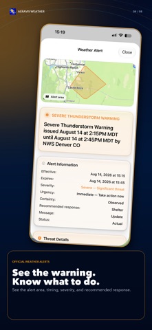
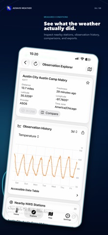
Aeravis Weather covers all the basics you expect from a weather app. Current conditions, hourly and 7-day forecasts, weather radar, alerts, and support across iPhone, iPad, and Apple Watch. At Stormwell Labs, we're not satisfied with just the basics. Aeravis contains so much more, starting with forecast comparison. FORECAST COMPARISON Weather is a fickle thing. As new observations arrive, forecasts shift, but those changes are rarely proactively communicated to you! With Aeravis Weather, you are brought into that process. Aeravis will notify you in the app when a meaningful change to the forecast occurs, giving you time to adjust your plans before an outdated expectation catches you by surprise. You can compare the consistency of forecasts from different providers to see where they agree and where uncertainty remains. When you want to know how accurate predictions for your location have been in the past, you can use specialized tools to see how they held up. Altogether, we hope that as a user of this app, you will never again find yourself wondering why meteorologists never seem to settle on a solution, because you will be able to see where forecasts agree, where uncertainty remains, and whether a change actually matters to you. COMPREHENSIVE MAPPING The native Weather Map provides so much more than just radar! Add layers for storm reports, surface observations from official weather stations, weather outlooks, or any of the more than a dozen provided layers. With the Weather Map, you can combine the info relevant to your life in one interactive visual to see where storms, alerts, outlooks, etc are in relation to you. The finished view is ready to be shared or made permanent as a preset, so you can return to it whenever the same question comes up and answer those burning questions that are best answered visually! CLIMATE RECORDS AND DROUGHT INFORMATION Aeravis makes it possible to see whether the weather you are experiencing is unusual or nearing a record high/low! You can compare observed temperatures and precipitation with 1991-2020 climate normals from a nearby climate station, and see just how widespread your yellowing grass is with the latest Drought Monitor maps for your city, region, and the United States as a whole. SEVERE WEATHER INFORMATION Stormy skies forecast? With Aeravis, you can follow a severe weather threat from the first outlook through the active warning phase. With access to official NWS outlooks, you can understand the type and severity of weather threatening your home as well as when the risk is expected. Read the meteorological discussions behind the outlooks to learn what NWS forecasters are watching for as they work to protect life and property, and why conditions support the expected storms. Aeravis brings this information together so you can understand the threat, prepare earlier, and make safer decisions wherever you are! PERSONALIZATION Aeravis works best when it’s organized to your liking! On the Home tab, you can reorder sections so the information you check most is at the top and less important sections are lower or hidden altogether. Choose the units, time format, theme, and map appearance settings that work best for you and save the views you return to most. Whether you want a quick glance at the essentials or a detailed dashboard with everything in view, Aeravis can be arranged around the way you actually check the weather!
Screenshots