DZMaster
Heidemarie Schmid

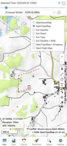
INTERACTIVE MAP AND UI - Map: Various base maps including satellite pictures and airspaces - Location: Comfortable selection of locations. Different coordinate formats. - Location search & favorites: A search panel for finding locations by names or coordinates. - Map tools: Zoom and measurement tools for distances, radii and bearings - Offline capability: Map tiles can be cached WEATHER FORECAST DATA & MODELS - Data source: Forecast data from OPEN METEO - Availability of global and regional forecast models - Time Slider: A time slider to choose hourly forecasts up to 7 days ahead - Historical Data: Date picker for weather data from the past - Autoupdate function for the forecasts - Units: Full control over various units - Mean wind calculation for customizable layers PARACHUTING & FLIGHT PLANNING - Landing Pattern visualization: adjustable landing pattern - Jump calculation: Visualization of the complete jump from exit to landing • Exit area • Canopy flight areas • Free fall trajectory - Jump Run Track (JRT): visualization auf der jump run and 2 minute approach - Cut-Away-Finder: visualization of the pontential landing spot for a cut away canopy - Track-Upload: import and visualization of GPX-, KML- und FlySight-CSV-Files - Live-Tracking & Jumpmaster-Line: • Live-Tracking • „Jumpmaster-Line“ from live position to the DIP or a manually set High Altitude Release Point (HARP). ENSEMBLE-FORECAST - Multi-Modell-Analysis: comparison of various forecast models - Szenarios: • All models: Shows exit circles for each chosen model • Min/Mean/Max Wind: Shows the exit circle for the weakest, strongest and mean wind • Heatmap: Shows a probability map for the exit area of all chosen models
Screenshots