Vortix Pro: Weather Radar Maps
Digital Edge Creations

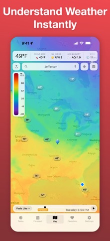
See the weather like never before. Vortix Pro puts live, animated weather radar on a beautiful interactive map — with forecast overlays, severe weather alerts, and aviation tools trusted by pilots. LIVE RADAR & SATELLITE Animated radar playback with timeline scrubbing. Global radar, US base reflectivity, US composite, and satellite imagery — all updating in real time. Scrub forward into forecast and nowcast frames to see what's coming. 17 GFS FORECAST OVERLAYS Go beyond radar. Visualize Temperature, Wind Speed, Wind Gusts, Precipitation, Snow Depth, Humidity, Pressure, Cloud Cover, UV Index, CAPE, Visibility, Dew Point, Feels Like, Wave Height, Soil Temp, Air Quality, and Dust & Smoke — up to 14 days out. SEVERE WEATHER ALERTS NWS alerts displayed as color-coded badges by severity. Tap for full alert details. Push notifications for lightning and hurricanes near your location. 10-DAY FORECAST & TODAY VIEW Swipe-up panels with current conditions, hourly breakdowns at 3-hour intervals, and expandable daily forecasts. Tap any stat for an interactive 24-hour bar chart. Conditions include Feels Like, Wind, Humidity, Pressure, UV Index, Visibility, Precipitation, and AQI. FAVORITES Save locations around the world. See current temp, conditions, and local time at a glance. Tap to fly the map there instantly. AVIATION WEATHER VFR & IFR sectional maps, airspace overlays (Class B/C/D/E with labels), TFRs, AIRSIGMETs, ADS-B traffic, and obstacle data. Built for pilots who need real situational awareness. HURRICANE TRACKER Active tropical cyclone tracks from the National Hurricane Center with forecast cones. LIGHTNING TRACKER Real-time lightning strikes on the map with configurable alert radius. DESIGNED TO BE BEAUTIFUL Glassmorphic UI with smooth animations, dark mode, and a responsive layout that adapts from phones to tablets to landscape. 18 LANGUAGES English, Spanish, French, German, Italian, Portuguese, Japanese, Korean, Chinese, and more. Vortix Pro offers a free tier with radar and NWS alerts. Unlock all overlays, aviation layers, and premium features with a subscription. Questions or feedback? We'd love to hear from you. A subscription provides access to premium features and future enhancements. Data Sources Weather data powered by Apple WeatherKit. Location Services Used to deliver accurate local forecasts, radar, and alerts.
Screenshots