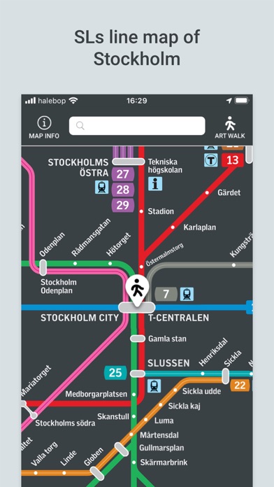
SL Transit Map Stockholm
DING

This app makes it easier for you to navigate using Stockholm’s public transportation system. It’s also a unique, free guide to the world-known art of the Stockholm metro. The Stockholm metro is colorful, to say the least. It’s the home to what’s known as the world’s longest art exhibition. Through in-app purchases, you gett access to the audio guide (professional voiceover) and remove the ads. LINE MAP OF STOCKHOLM TRANSPORTATION A map of transportation methods where you can easily search each train station from any location. The map includes: - Metro - Commuter Trains - Roslagsbanan - Saltsjöbanan - Trams - Nockebybanan - Lidingöbanan - Spårväg City - Citybanan STOCKHOLM ART WALK Close to 90 of the 100 metro stations offer unique artworks. We have selected the 5 stations that we feel are the most interesting. Stockholm Art Walk is a 1 hour long guided tour through the stations T-Centralen, Kungsträdgården, Rådhuset, Stadshagen and Solna Centrum where you can be inspired and take pictures of the unique art collection in your own time. ABOUT THE APP The app is partially funded with ads. You can opt out of showing the ads through a in-app purchase. The app was developed by DING to make your public transportation traveling easier. The app is not an official app from Stockholm's local traffic and the map shown in the application is owned by SL (Stockholms Lokaltrafik) and used with permission from SL.
Screenshots