GPS Fields Area Measure Map
Rento UAB

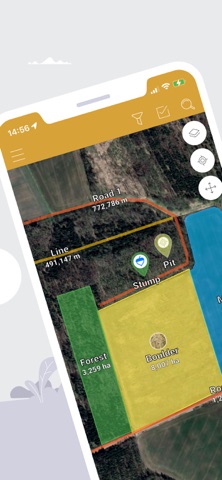
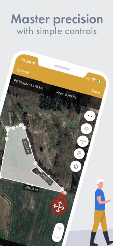
GPS Fields Area Measure lets you accurately calculate distance, perimeter and area — even without internet. Mark any point with notes, photos or custom data. Ideal for field scouting, equipment tracking, land inspection or issue logging. Designed for: ------------- • Farmers & agronomists (field mapping, crop scouting, fertilizer & spray planning, issue logging) • Land surveyors & construction (fencing, irrigation layout) • Real estate & property teams (map parcels and store notes, photos & site info) Key Features: ------------- • One-tap GPS walking/driving measurement • Precise manual editing with point markers • Add notes, photos & custom objects • Fully offline — works anywhere • Save, group & edit projects • Export to KML, KMZ or Shapefile • Add custom map layers — drone imagery, raster maps or any WMS service • Elevation profiles & built-in compass What our users say: ------------------- “Best measuring app I’ve ever used. Replaced my expensive handheld GPS.” — John, USA “Perfect for remote areas with no signal.” — Maria, UK “Great for property inspections. All my notes, photos and boundaries are stored in one app — no more messy folders.” — Mark, Australia 4.6 stars from 11K+ reviews • Used in 150+ countries • Regular feature updates Download free. Unlock Premium for advanced tools and cloud storage. • Privacy policy: https://privacy.farmis.com/ • Terms of Use: https://privacy.farmis.com/
Screenshots