Topographical charts Holland
Surfcheck

This app is mainly aimed for use in the Netherlands, and contains unique topographical maps, aerial photography maps and the current maps used and published by the Dutch land registry office. Live from the governmental systems. Data that is best in class.
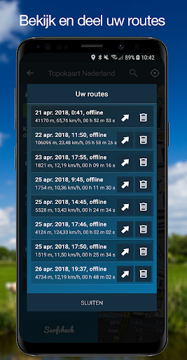
Please do mind: the app also contains an excellent and very stable GPS tracker - available as a pro feature - and features Open Street Map maps for all the countries outside the Netherlands. The interface language though, is in Dutch.
Disclaimer
We do our utmost to deliver you the best software and data available in the market, but of course we cannot guarantee the proper functioning or accuracy of both. Data sources can change over time. You can not derive rights from this information. By downloading and using this app you accept these terms.
Location
The location permission is necessary to enable the app to show you your current position. It is not used nor stored for anything else at all.
Please do mind: the app also contains an excellent and very stable GPS tracker - available as a pro feature - and features Open Street Map maps for all the countries outside the Netherlands. The interface language though, is in Dutch.
Disclaimer
We do our utmost to deliver you the best software and data available in the market, but of course we cannot guarantee the proper functioning or accuracy of both. Data sources can change over time. You can not derive rights from this information. By downloading and using this app you accept these terms.
Location
The location permission is necessary to enable the app to show you your current position. It is not used nor stored for anything else at all.
Developer email
post@surfcheck.info
Developer website
https://topokaartnederland.nlReleased
Apr 28, 2018
Current version
3.4
Android version
5.0
Screenshots