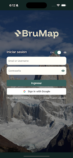
BruMap - Outdoor Tool
Nature Labs Apps

BruMap (ex Patagonia Trail) is more than an app, is the new way to enjoy nature.
BruMap, as a tool, is for everyone that loves, enjoy or work in outdoor. It has all the features for planning or on-field that you need in nature for outdoor sports, science field, conservation or managing a park or private reserve.
Institutions, associations, experts or adventurers are different users of the same app.
Institutions or Associations have the privilege to add waypoints virtually on nature to sign places, inside of a trail in a, for example, National Park to use by app to create push notifications to users that pass for this geolocation.
Stop using wood or metal signs and go virtually without polluting the environment.
Experts and Adventures are just one. You can show to others your expertise and be verified as an expert by others. This feature will allow you to, for example, meet another user to rock climb with him and trust in information because of verifications.
BruMap has all you need.
- Maps 2D and 3D with offline layers and contours, tracking and realTime sharing with other adventurers.
- Import, Save and Export KML/GPX files.
- Compass-Ray: 100km Compass in 2D and 3D maps!
- Import a PNG and geolocate to navigate above it, or use just a WMS Geoserver!
- Registration (Parks and inApp) will allow you to share your information registration to meet other users, for sharing in emergencies or just to have a history of your tracks. Also allows you to be notified of INaturalist or InApp waypoints.
- SelfGuided with AI use INaturalist and Information Waypoints to guide you as a real Tourist Guide around you are tracking!
- Professional Weather in specific Lat-Long with different world wide accepted models
- Science: Look for INaturalist waypoints, songs of birds or just make a Conservation Report.
- Find your buddy to go for an adventure in the "Buddies" section!
- Thousand of public trails of OSM.
- SOS Slider: Ask for help easily sharing in real time your position and having all Emergency numbers and links needed.
As Institution you will be able to manage specific region trails:
- Upload a KML or GPX file and create details as difficulty, distance, elevation, etc.
- Change visibility
- Show in specific cases as “Required Payment” or “Required Registration”.
As Hut or Mountain Camp you will be able to manage information of this Specific camp and registration night.
BruMap, all in one. Be part.
BruMap, as a tool, is for everyone that loves, enjoy or work in outdoor. It has all the features for planning or on-field that you need in nature for outdoor sports, science field, conservation or managing a park or private reserve.
Institutions, associations, experts or adventurers are different users of the same app.
Institutions or Associations have the privilege to add waypoints virtually on nature to sign places, inside of a trail in a, for example, National Park to use by app to create push notifications to users that pass for this geolocation.
Stop using wood or metal signs and go virtually without polluting the environment.
Experts and Adventures are just one. You can show to others your expertise and be verified as an expert by others. This feature will allow you to, for example, meet another user to rock climb with him and trust in information because of verifications.
BruMap has all you need.
- Maps 2D and 3D with offline layers and contours, tracking and realTime sharing with other adventurers.
- Import, Save and Export KML/GPX files.
- Compass-Ray: 100km Compass in 2D and 3D maps!
- Import a PNG and geolocate to navigate above it, or use just a WMS Geoserver!
- Registration (Parks and inApp) will allow you to share your information registration to meet other users, for sharing in emergencies or just to have a history of your tracks. Also allows you to be notified of INaturalist or InApp waypoints.
- SelfGuided with AI use INaturalist and Information Waypoints to guide you as a real Tourist Guide around you are tracking!
- Professional Weather in specific Lat-Long with different world wide accepted models
- Science: Look for INaturalist waypoints, songs of birds or just make a Conservation Report.
- Find your buddy to go for an adventure in the "Buddies" section!
- Thousand of public trails of OSM.
- SOS Slider: Ask for help easily sharing in real time your position and having all Emergency numbers and links needed.
As Institution you will be able to manage specific region trails:
- Upload a KML or GPX file and create details as difficulty, distance, elevation, etc.
- Change visibility
- Show in specific cases as “Required Payment” or “Required Registration”.
As Hut or Mountain Camp you will be able to manage information of this Specific camp and registration night.
BruMap, all in one. Be part.
Developer email
info@naturelabsar.com
Developer website
https://brumap.comReleased
Oct 30, 2025
Current version
2.6
Android version
7.0
Screenshots