GPS Camera: GeoTag Photos
TALYMIND APPS LTD

4.6 stars126 reviews100,000+Free
PhotographyEveryoneVersion 3.1Updated 5/20/2026, 1:57:02 PM
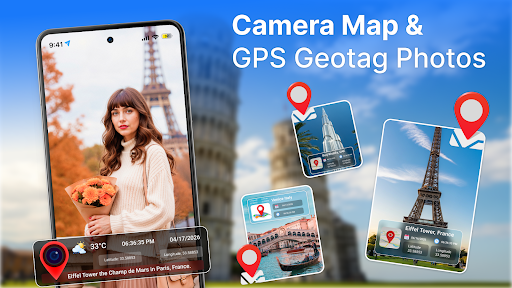
Open in StoreCapture your moments with precision using GPS Map Camera: GeoTag Photos, the ultimate app that lets you take photos with accurate location details, apply quick edits, and view your entire journey on a beautiful map gallery.
Whether you're traveling, exploring nature, documenting work, or simply keeping memories organized, this app makes every photo count. With GPS Map Camera: GeoTag Photos, your pictures automatically include essential information such as location coordinates, address, date, and time.
You can edit your photos right after capturing them, add filters, adjust brightness, crop images, and enhance your shots to perfection. Every photo you save is easy to find and organized visually through an interactive map, helping you relive your moments with just a tap.
This app is perfect for travelers, photographers, delivery professionals, adventure lovers, and anyone who wants detailed location history in their photo collection. No more guessing where a photo was taken your camera does it for you.
Key Features ofGPS Map Camera: GeoTag Photos:
- Take photos with precise location data. Every shot automatically includes GPS coordinates, address, date, and time ideal for travel logs, fieldwork, and documentation
- View all your photos on an interactive map. Explore your memories visually and track your journey effortlessly.
- Edit your photos instantly, apply filters, adjust colors, crop images, and enhance your pictures without leaving the app.
- Enjoy a smooth and clean camera experience with stable performance and sharp image output
- All edited and captured photos are saved directly to your device’s gallery for easy sharing.
- Sort, browse, and organize your images with location-based grouping and smart map navigation.
- Ideal for travellers, bloggers, explorers, real estate agents, construction workers, surveyors, and professionals who need reliable location-tagged photos.
- Why GPS Map Camera: GeoTag Photos?
- Simple, fast, and beginner-friendly
- Accurate location stamping
- Integrated editing tools
- Clean map-based photo browsing
- Great for documenting trips and projects
Whether you're capturing beautiful landscapes, marking your work progress, or saving important moments with exact location details, GPS Map Camera: GeoTag Photos gives you everything you need in one app.
Whether you're traveling, exploring nature, documenting work, or simply keeping memories organized, this app makes every photo count. With GPS Map Camera: GeoTag Photos, your pictures automatically include essential information such as location coordinates, address, date, and time.
You can edit your photos right after capturing them, add filters, adjust brightness, crop images, and enhance your shots to perfection. Every photo you save is easy to find and organized visually through an interactive map, helping you relive your moments with just a tap.
This app is perfect for travelers, photographers, delivery professionals, adventure lovers, and anyone who wants detailed location history in their photo collection. No more guessing where a photo was taken your camera does it for you.
Key Features ofGPS Map Camera: GeoTag Photos:
- Take photos with precise location data. Every shot automatically includes GPS coordinates, address, date, and time ideal for travel logs, fieldwork, and documentation
- View all your photos on an interactive map. Explore your memories visually and track your journey effortlessly.
- Edit your photos instantly, apply filters, adjust colors, crop images, and enhance your pictures without leaving the app.
- Enjoy a smooth and clean camera experience with stable performance and sharp image output
- All edited and captured photos are saved directly to your device’s gallery for easy sharing.
- Sort, browse, and organize your images with location-based grouping and smart map navigation.
- Ideal for travellers, bloggers, explorers, real estate agents, construction workers, surveyors, and professionals who need reliable location-tagged photos.
- Why GPS Map Camera: GeoTag Photos?
- Simple, fast, and beginner-friendly
- Accurate location stamping
- Integrated editing tools
- Clean map-based photo browsing
- Great for documenting trips and projects
Whether you're capturing beautiful landscapes, marking your work progress, or saving important moments with exact location details, GPS Map Camera: GeoTag Photos gives you everything you need in one app.
Developer email
info@talymindapps.com
Developer website
http://talymindapps.comReleased
Mar 13, 2026
Current version
3.1
Android version
7.0
Reviews & Ratings
4.6
out of 5
5
4
3
2
1
😊 Highly rated by users
126 reviewsScreenshots