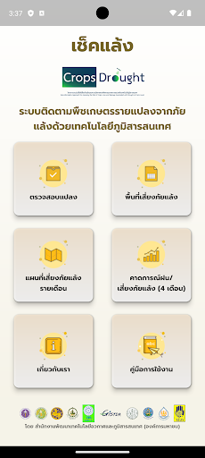
เช็คแล้ง
สำนักงานพัฒนาเทคโนโลยีอวกาศและภูมิสารสนเทศ GISTDA

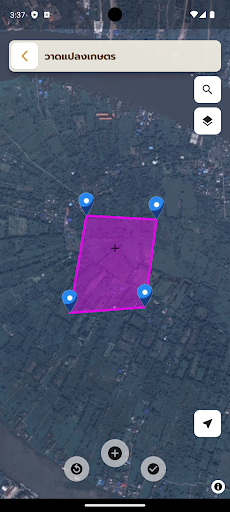
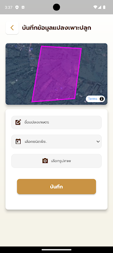
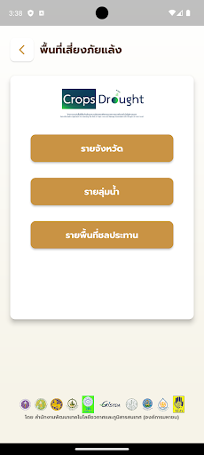
This application was developed to enable farmers to monitor drought risk in their fields for planting four important economic crops, namely rice, corn, cassava and sugarcane, from satellite and geographic information processing systems developed under the project. "Create a system to assess drought-risk areas of agricultural crop plots from models using geo-informatics technology" to support use in all areas throughout the country.
Developer email
innotech@gistda.or.th
Developer website
https://www.gistda.or.th/home.phpReleased
Jan 31, 2024
Current version
2.0.11
Android version
6.0
Screenshots